How it works
The equipment includes a digital camera that rides on a small 4lb remote controlled aircraft. The camera is controlled by the pilot or a 2nd camera operator. The cameras signal is fed to a video transmitter and the signal is picked up by a receiver on the ground and fed to a video screen. The camera operator uses this as a virtual viewfinder to see the image the camera sees. The final images come directly from the cameras memory card so there is zero loss from transmitting images to the ground as in some other systems. After many photos or videos are taken the aircraft is landed and the images are removed from the camera.
First Person View Project
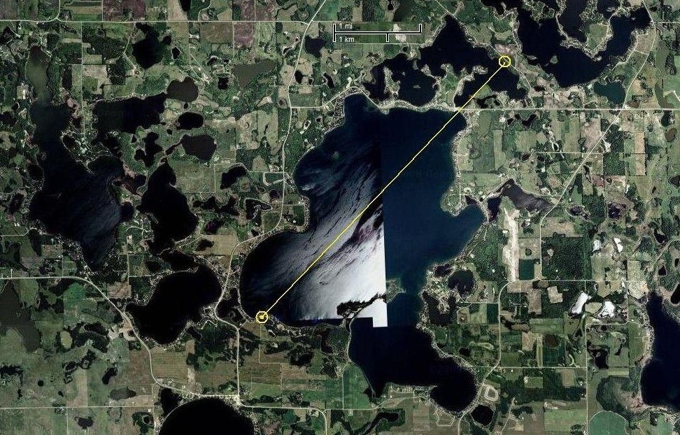
Initial testing has begun with a range test of the video transmitter and control transmitter. The test was conducted on the ground at a 0.75 mile and 4 mile waypoint. The 0.75 mile point was across Leaf Lake and the 4 mile point was across both Leaf Lake and Cormoront Lake. Both Video and Controls operated fairly well at the 4 mile waypoint. It turned out my 4 mile waypoint was not actually line-of-sight but probably just some trees and possibly a small hill in the way. Above is a sattelite view of My video range test. The transmitter was at one end of the yellow line and the reciever was at the other end.
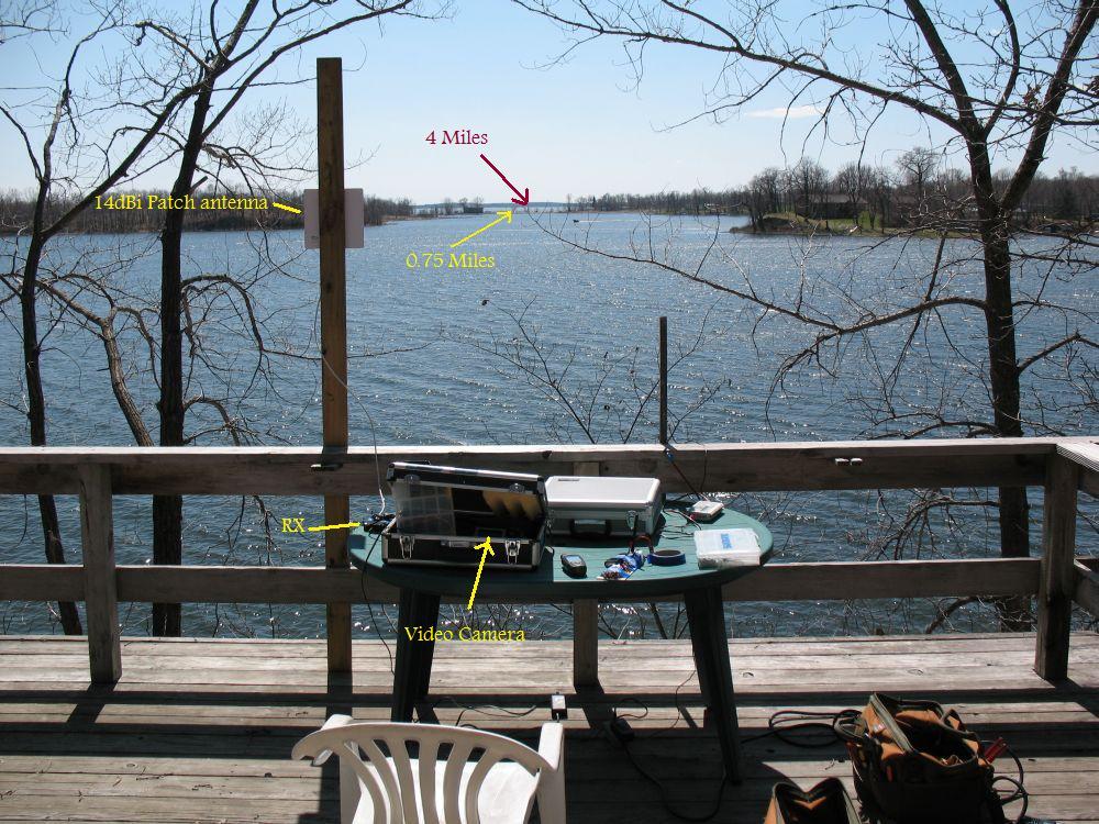
 View of the receiver location. A 14dBi Patch antenna connected to 2.5GHz receiver and recorded into a video camera (located in shade provided by the briefcase for easier viewing).
 View through a 15 power telescope.